

As part of its educational and scientific-outreach activities, the Faculty of Medicine held a practical seminar on October 1, 2026, titled "STI Preven
Quotation gallery
Teachers open the door, but you must enter by yourself.
Chinese Proverb
Faculty’s news
29 сентября — Всемирный день сердца! В честь этой даты медицинский факультет совместно с психологической службой университета организовал информацион
To foster social and educational engagement, promote medical science, and spark student interest in medical research and knowledge, the "Med-Quiz" bli
29 сентября 2026 года со студентами групп 2 мед 26-1 и 2 мед 26-2 проведён куратором Шилкиной Ольгой Ивановной экологический час на тему «Экология нач
28 сентября 2026 г. состоялся творческий вечер «Мир книг: читаем, обсуждаем, открываем» среди студентов специальности «Фармация». Творческий вечер пр
25 сентября 2026 года со студентами групп ОМ 26-2к, ОМ 26-3 медицинского факультета состоялся круглый стол на тему «Конституция — основа стабильности
16 сентября для студентов медицинского факультета в рамках эдвайзерского часа было проведено мероприятие на тему «Закон и порядок — основа безопасного
The Faculty of History, Economics, and Law hosted a scholarly roundtable titled "Northern Kazakhstan within the Steppe Communication Network of the
The Faculty of History, Economics, and Law hosted a scholarly roundtable titled "Northern Kazakhstan within the Steppe Communication Network of the Go
Проведён семинар по академической политике вуза с участием студентов групп Мед 3-26. В ходе мероприятия обучающиеся ознакомились с основными положения
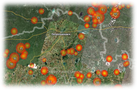
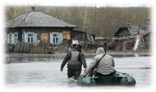
Modeling the development of a flood situation in the North Kazakhstan region with the construction of a full-scale model based on data from remote sensing of the Earth
Priority area: Information, telecommunication and space technologies, scientific research in the field of natural sciences
Project manager: Sartin S.A., candidate of physical and mathematical sciences.
Project executors: Ruder V.P., master, Shchukina V.N., master, Fomin I.A., master, Ponomarenko A.S., master.
Terms of execution: 2018-2020
Amount of financing: 94,200,000 tenge.
The goal of the project is to obtain high-resolution remote sensing data (via aerial photography) and process them using geographic information systems (GIS). Development and testing of a sensor for automatic detection of snow cover thickness.
Expected results: to develop a mathematical model for the forecast of spring flooding on the Yessil river, which will provide a forecast of the water rise level near settlements with an accuracy of 1-2 meters, will allow modeling the zones of probable flooding, track the dynamics of flooding processes in floodplain territories, and assess the flooded areas by means of an unmanned aircraft. The implementation of this project will allow you to obtain and constantly Refine a 3d model of the floodplain relief.
Project description: Currently, work is actively underway in the field of remote sensing of the earth using modern geodetic equipment, as well as unmanned aerial vehicles (UAVs). It is planned to create a full-scale model of the Yessil (Ishim) river floodplain, data on the depth of snow cover in the Yessil (Ishim) river basin, and bottom profiles obtained using a six-beam echo sounder to create a full-scale model of the Yessil (Ishim) river flood near localities and the degree of their flooding. Development of a model for the development of the flood situation between the cities of Sergeevka and Petropavlovsk. The model will be adjusted quickly to take into account newly received data on the state of snow cover in the Yessil river basin (Ishim).
Project objectives:
−obtaining high-precision geodetic data on the Esil river floodplain;
−obtaining data on the state of the Esil river bed;
−development and implementation of methods for remotely obtaining data on the state of snow cover in the Esil river basin;
−creation of a model of the passage of melt water along the bed of the Esil River;
−data visualization and creation of a computer model to display the development of the flood situation;
−obtaining a computer model showing the flooding zones.