On May 20, 2026, a significant meeting was held at the university with the Hero of Kazakhstan, the People's Hero, the cosmonaut pilot, the third cosmo Read more
Quotation gallery
Success doesn’t come to you…you go to it.
Marva Collins
Faculty News
On April 25, the 18th Republican Subject Olympiad in the field of Law was held at the Caspian University, bringing together the strongest students fro Read more
Пожароопасный сезон в лесах СКО в самом разгаре. Правила обращения с огнем и любовь к природе – первоосновы воспитания наших маленьких сограждан. В ра Read more
On April 17, 2026, as part of the Week of Science, the role-playing game «Court in a Criminal Case» was held. The event was held as an open criminal t Read more
On April 17, 2026, a solemn ceremony was held at Kozybaev University to award personalized scholarships dedicated to the legacy of Alexander Sergeyevi Read more
On April 16, 2026, at the Faculty of History, Economics, and Law, a solemn ceremony was held to equip the certified 1C-Accounting center with modern c Read more
On April 10, 2026, the Faculty of History, Economics, and Law hosted a session titled «Legal and Socio-Economic Aspects of Society's Development in th Read more
Гранты Read more
The M. Kozybayev North Kazakhstan University hosted the International Scientific and Practical Conference «Kozybayev Readings 2026», dedicated to the Read more
On April 8, 2026, the educational programs developed by the Academy of the International Financial Center «Astana» were officially transferred to the Read more
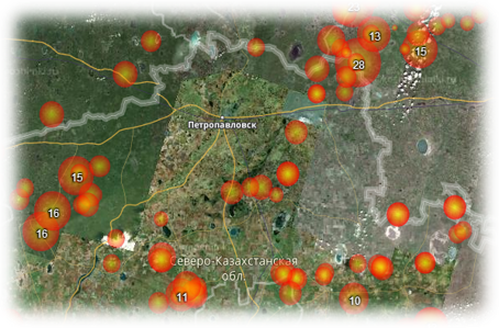
Modeling the development of a flood situation in the North Kazakhstan region with the construction of a full-scale model based on data from remote sensing of the Earth
Priority area: Information, telecommunication and space technologies, scientific research in the field of natural sciences
Project manager: Sartin S.A., candidate of physical and mathematical sciences.
Project executors: Ruder V.P., master, Shchukina V.N., master, Fomin I.A., master, Ponomarenko A.S., master.
Terms of execution: 2018-2020
Amount of financing: 94,200,000 tenge.
The goal of the project is to obtain high-resolution remote sensing data (via aerial photography) and process them using geographic information systems (GIS). Development and testing of a sensor for automatic detection of snow cover thickness.
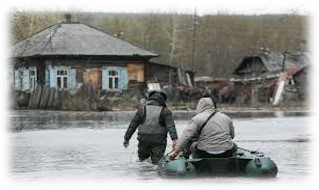
Expected results: to develop a mathematical model for the forecast of spring flooding on the Yessil river, which will provide a forecast of the water rise level near settlements with an accuracy of 1-2 meters, will allow modeling the zones of probable flooding, track the dynamics of flooding processes in floodplain territories, and assess the flooded areas by means of an unmanned aircraft. The implementation of this project will allow you to obtain and constantly Refine a 3d model of the floodplain relief.
Project description: Currently, work is actively underway in the field of remote sensing of the earth using modern geodetic equipment, as well as unmanned aerial vehicles (UAVs). It is planned to create a full-scale model of the Yessil (Ishim) river floodplain, data on the depth of snow cover in the Yessil (Ishim) river basin, and bottom profiles obtained using a six-beam echo sounder to create a full-scale model of the Yessil (Ishim) river flood near localities and the degree of their flooding. Development of a model for the development of the flood situation between the cities of Sergeevka and Petropavlovsk. The model will be adjusted quickly to take into account newly received data on the state of snow cover in the Yessil river basin (Ishim).
Project objectives:
−obtaining high-precision geodetic data on the Esil river floodplain;
−obtaining data on the state of the Esil river bed;
−development and implementation of methods for remotely obtaining data on the state of snow cover in the Esil river basin;
−creation of a model of the passage of melt water along the bed of the Esil River;
−data visualization and creation of a computer model to display the development of the flood situation;
−obtaining a computer model showing the flooding zones.